Falklands: mines discovered on a beach in Murrell Peninsula, north of Stanley
[ad_1]
Falklands: mines discovered on a beach in Murrell Peninsula, north of Stanley
The Falklands Government is working alongside the EOD section of BFSAI and expert advice is also being provided by external parties.
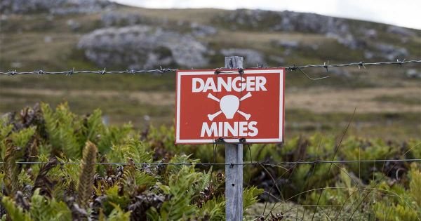
The Falkland Islands Government has confirmed that a number of mines have been discovered on Hell’s Kitchen beach on the designated Government Reserve, located on the Murrell Peninsula East Falkland, north of Stanley.
The area was a suspect area on minefield maps. During the demining program the location was surveyed and cleared for mines. Thorough work to the highest international standard was undertaken by the team; nevertheless there always was and still is a possibility that mines could subsequently be discovered. The Falklands Government is working alongside the EOD (Explosive Ordnance Disposal) section of BFSAI and expert advice is also being provided by external parties.
While next steps are being prepared, a larger section of the area will be fenced in a similar manner as for previous minefield sites. The public are reminded that access to the Murrell Peninsula is via private land and therefore the landowner’s permission must be sought. Anyone intending on visiting the Murrell Peninsula should liaise with the landholders who will provide maps identifying the cordoned area at Hell’s Kitchen.
The public are asked to not enter the area for their own safety. Sailing is permitted no closer inshore than 0.5 miles from the shoreline, and mariners are advised to not land on the beach within the fenced cordon.
FIMA will issue a Local Notice to Mariners (LNTM) 06/2023 – ‘Mines found in Hell’s Kitchen
It is advisable for the public to download the What3Words app to their smart phone. If you see any suspicious objects mark the location at a safe distance and please report your finding to the Royal Falkland Islands Police on 999.
It s estimated that some 20,000 personnel and antitank mines were planted by the retreating Argentine forces in 1982. But in 2009 UK implemented a mine clearance program that successfully, with Zimbabwean experts cleared fields and beaches.. In November 2020 UK and Falklands declared the Islands mine free and Islanders celebrated by recovering Yorke Bay, close to Stanley and out of bounds for almost four decades.
Allegedly Argentine officers from the Engineers Corps handed the British maps with details of the areas with planted bombs, which also helped in the clearance. But in sand dunes and close to the sea nothing is certain, particularly with ordnance made of plastic.
Robin Goodwin, sheep farmer in the Murrell Peninsula area has said that the discovery proves that not all mines were mapped as suggested. Could there be other areas yet to be discovered. I hope not because while this discovery was visible the next one may not be until stood on.
This find does demonstrate that the Argentines did not map all mines laid. Be vigilant folks, the last thing you want is to be injured or killed by trodding on one of these nasty bits of kit.
I trust the authorities are also now talking to those who laid them to ascertain how many more may be around we don´t know about.
This is not a scaremongering post but reality that everyone needs to take extra care when out and about and do as the government says. Report it and mark it but never touch.
[ad_2]
Source link


